 Early Maridia
by Kabutroid [profile]
User's Web Page
N 49° 36.102 W 096° 50.358
UTM: 14U E 656120 N 5496589
In Manitoba, Canada
Hidden: 12/07/2006
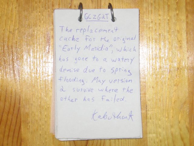
Use waypoint: GCZG2T

A strange cement ramp crossing a stream. Minor waterfall-type drop, shallow waters, and fun to drive or walk across. Somewhat rough roads (if you can call them that) leading up to it.
This is a place I constantly played at as a kid. Either on a bike or just walking, we would constantly hop across the rocks or play in the water, catching crayfish, minnows, or just generally... playing.
............
We grew up in the country. Things like this were considered fun out there :P.
This ramp is used by tractors on rare occasion to get across the stream from one field to another, so watch for tractors if it's planting/harvesting season. In the many years I've played there, I've never yet physically seen a tractor go across, so I'd be surprised if anyone saw one. Not that it matters that much, since the cache can be accessed entirely without crossing it, or any road. Just park at the bridge, and walk along the edge of the water. There's a good 30 or so feet of "bank" you can walk along before you're on the dirt road leading up to the location itself.
The cache itself is nowhere close to the fields, but is along the canal (Manning canal to be specific). Just follow the dirt roads (if you can even call them THAT) to get to it. If you have a low-riding car, I'd suggest parking it at the Manning canal bridge and walking. If you have a vehicle not afraid of a few bumps, by all means take it down the ramp. I assure you, it's quite fun, provided it's not too muddy to get stuck when off the cement. BE WARNED: If you DO get stuck... you may have a difficult time getting a tow-truck to locate you. ATTEMPT AT YOUR OWN RISK.
To get the cache, actually stepping onto the rocks in the canal or wading is NOT required (provided you're on the right side), nor is crossing a road or the ramp itself.
When you find it, you'll notice it's tethered. This is to avoid the potential floating-away problem if spring waters get too high (though I can't recall ever seeing the spring water get that high anyway, but why take chances). Just hide the tether back behind the cache when you're done. It's about 6 feet long, and can be easily unclipped if you want to take it further.
Original contents are:
Logbook, two pencils, and a sharpener
Roll of camouflage tape
Matchbox car
Normal-shaped caribiner
Duck-shaped caribiner
Bouncy ball
chainmaille ball
Rubber chicken
FTF prize (handmade titanium chainmaille bracelet) & certificate
My first cache ever, so I hope you enjoy :} Final note/warning though... if your name isn't in the logbook, it isn't on the website :P.
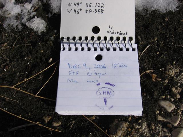
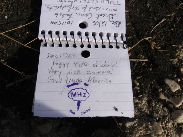
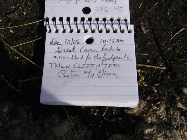
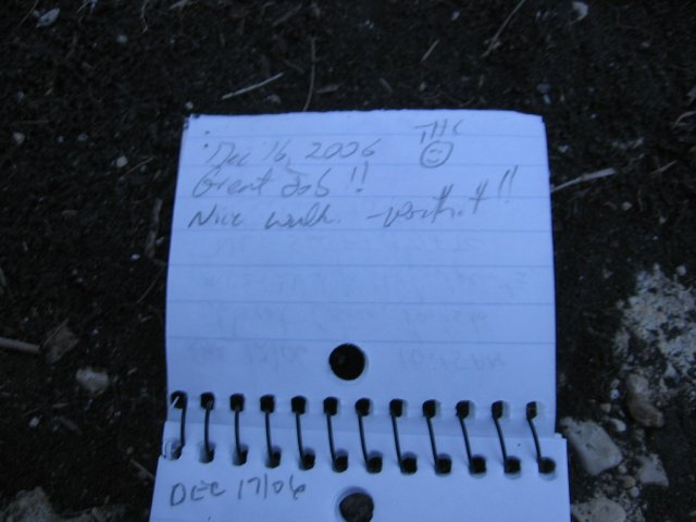
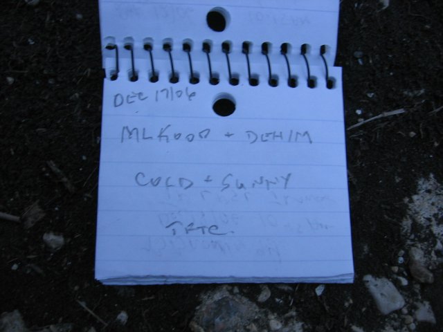
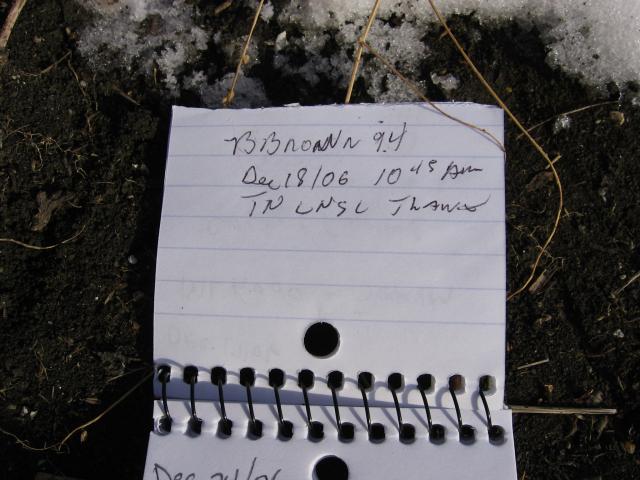
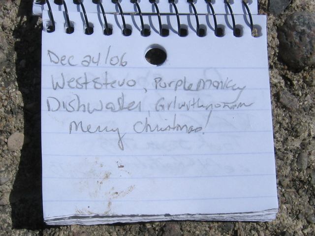
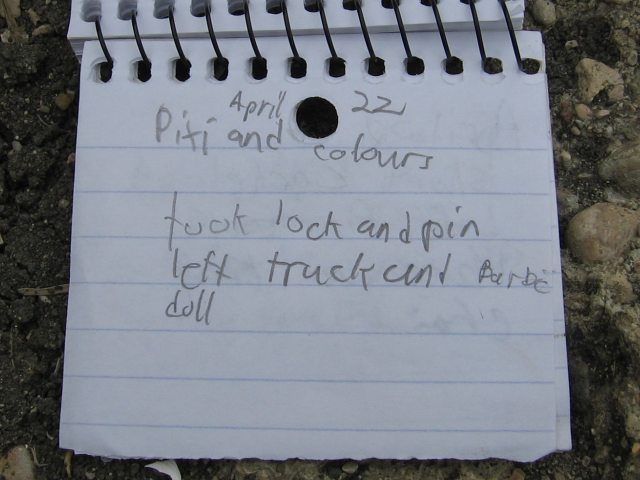
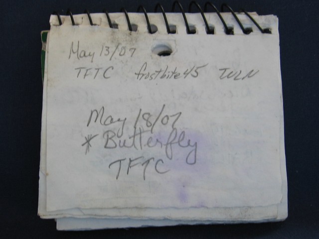
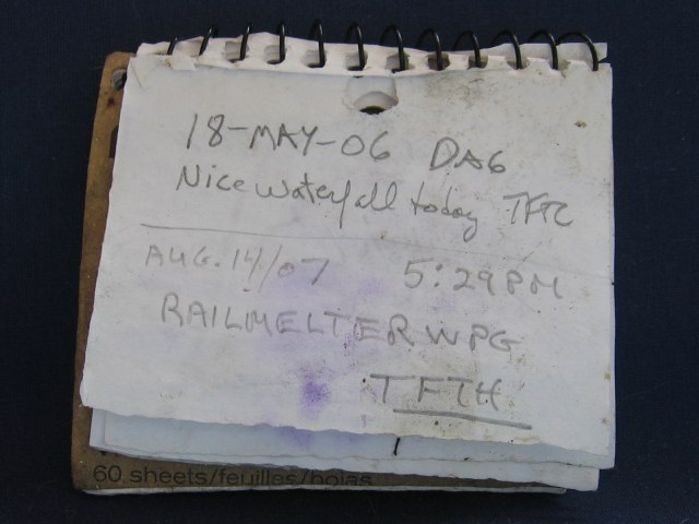
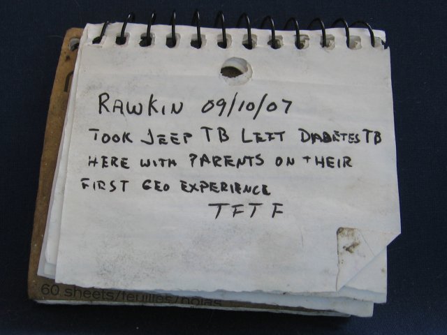
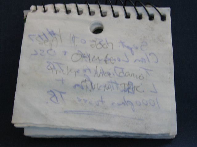
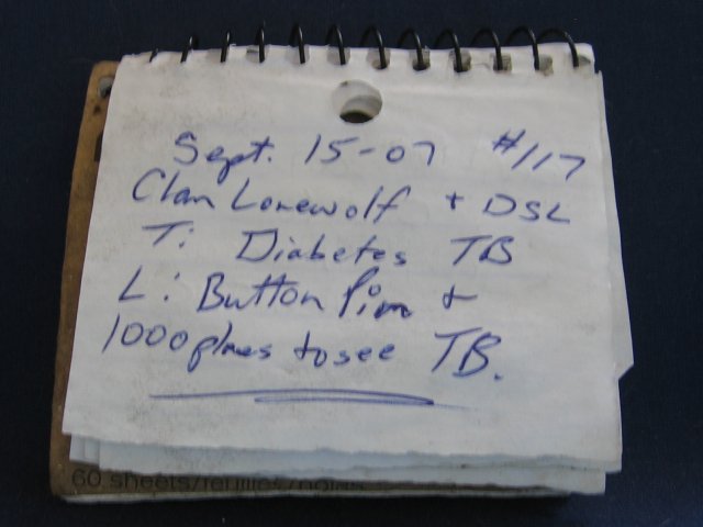
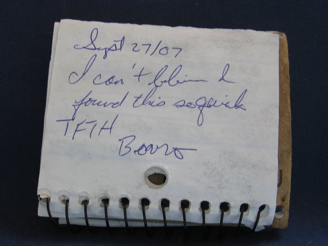
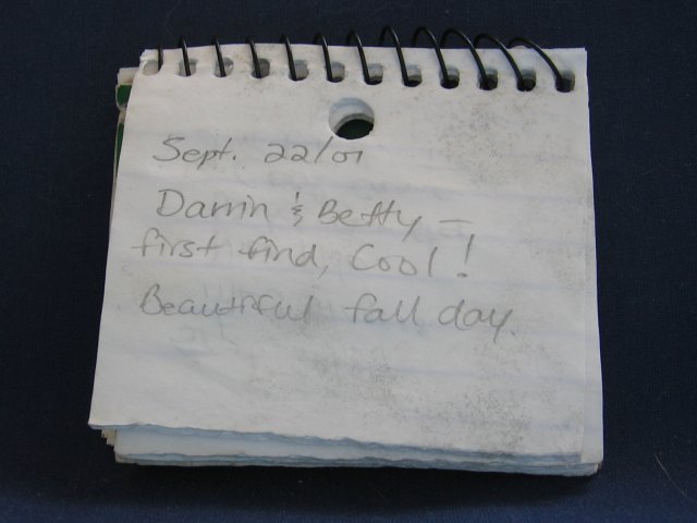
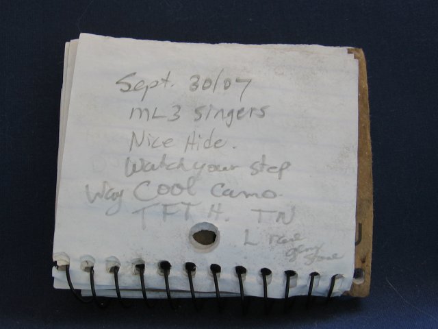
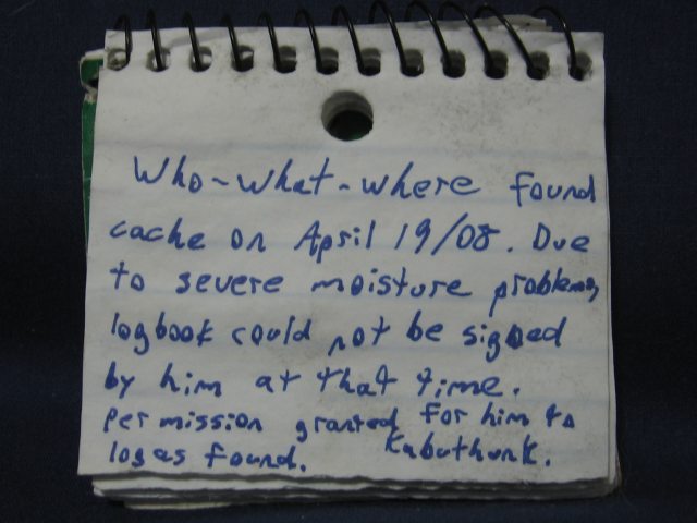
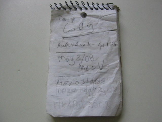
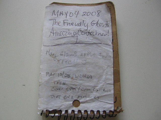
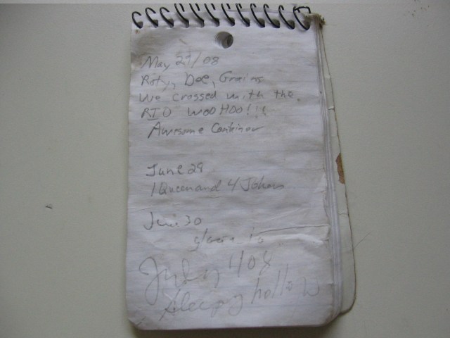
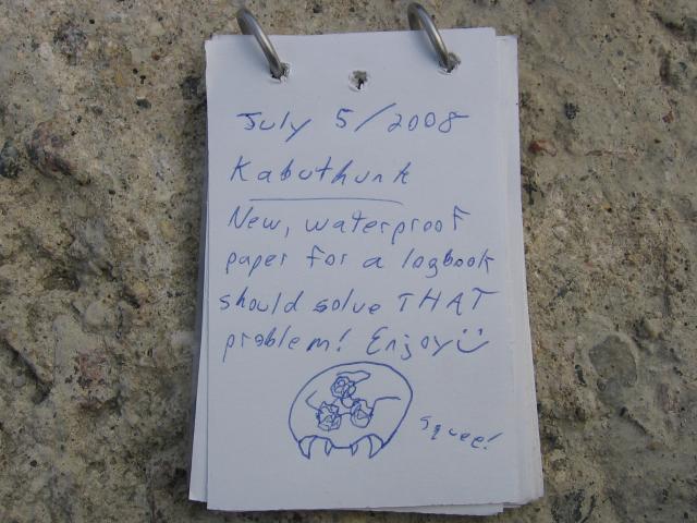
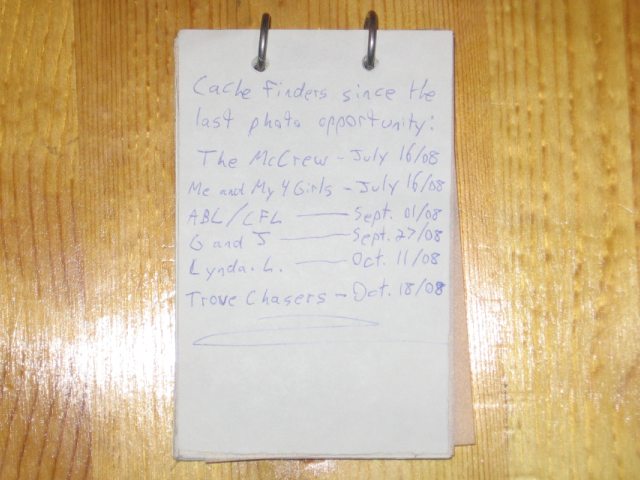
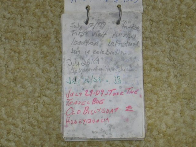
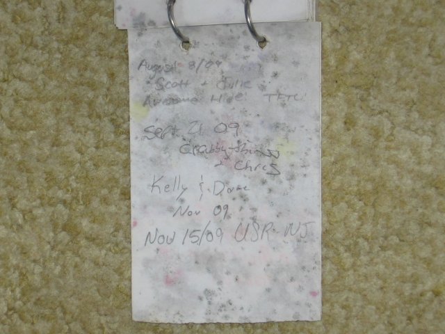
The logbook pages can be seen over here, updated whenever I'm able.
A|B|C|D|E|F|G|H|I|J|K|L|M
-------------------------
N|O|P|Q|R|S|T|U|V|W|X|Y|Z
(letter above equals below,
and vice versa)
|
Additional Waypoints | |
| Parking spot | N 49° 36.312 W 096° 50.900 |
| You can pull your car off the road and park here, and walk from this point on if you don't want to drive down the dirt road. | |
| Parking spot | N 49° 36.310 W 096° 50.793 |
| You can pull your car off the road and park here, and walk from this point on if you don't want to drive down the dirt road. | |
| Other place I used to play as a child | N 49° 37.194 W 096° 50.621 |
| The other place I played at as a kid. Basically just a ditch along what we called "gopher road" that would get lots of water in it. Not really worth stopping, but it's something to look at as you drive by if you're taking this road to or from the cache. | |
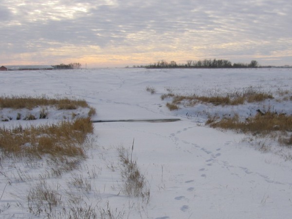
View from afar... in winter
Strangely, the shallowest part of the canal (ie: the ramp part) takes the longest to freeze (if at all). Since it's so much shallower there, the water runs much faster over it, not giving it a chance to freeze solid.
How the cache was built
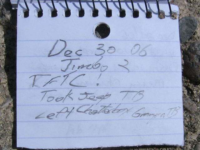
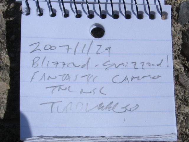
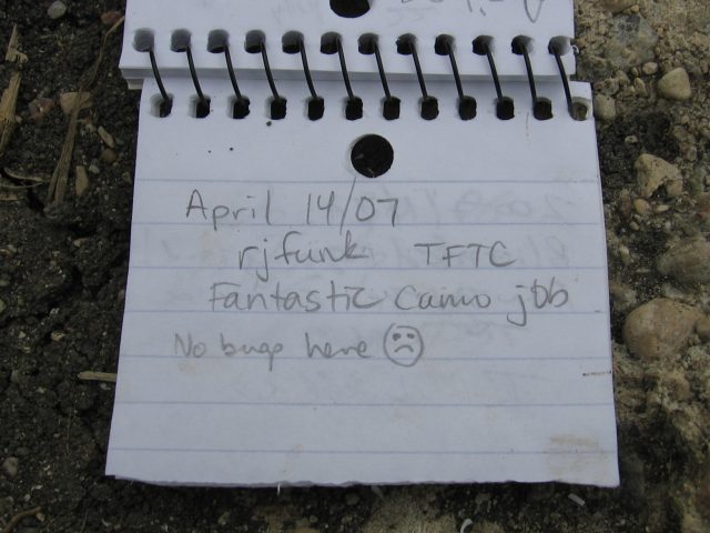
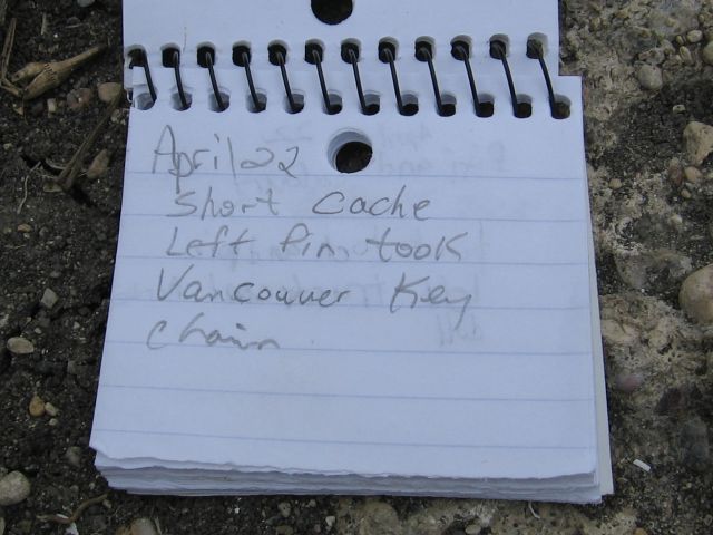
View logbook: Page 1, 2, 3, 4, 5, 6, 7, 8, 9, 10, 11, 12, 13, 14, 15, 16, 17, 18, 19, 20, 21, 22, 23, 24, 25, 26, 27, 28, 29, 30.
